Cognitive Cartography for Subterranean Navigation: Mapping Human Spatial Awareness in GPS-Denied Environments
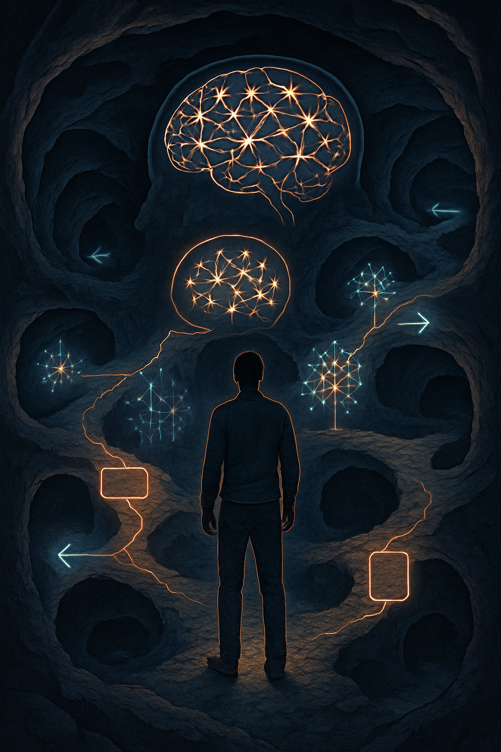
Cognitive maps are internal representations of spatial environments that humans and other animals use to navigate. These mental models are particularly crucial in GPS-denied environments where external navigational aids are unavailable. Subterranean settings, such as caves, mines, and underground infrastructure, present unique challenges to human spatial awareness due to their complex three-dimensional (3D) layouts, lack of consistent distal cues, and often disorienting or feature-poor nature. Understanding how individuals form and utilize cognitive maps in these environments—a field we term 'cognitive cartography for subterranean navigation'—is essential for improving safety, efficiency, and the design of underground spaces.
This article explores the foundations of cognitive mapping without GPS, the sensory and environmental cues employed, the psychological and neurobiological underpinnings of subterranean spatial awareness, and the practical applications and future directions for this research.
Foundations of Cognitive Mapping in GPS-Denied Environments
Humans, like many other species, possess an innate ability to learn and remember spatial information to navigate their surroundings. Research on animal navigation, such as the vector-based navigation strategies of desert ants (Voegeli et al., 2024), reveals sophisticated internal systems for path integration and cue-based wayfinding even in seemingly featureless terrains. These systems allow for the creation of novel shortcuts and flexible navigation without relying on a global positioning system. In humans, spatial decision-making, particularly at critical junctures like intersections, involves a dynamic process of information seeking and environmental cue interpretation (Brunyé et al., 2018). This process begins even before reaching the decision point, suggesting an anticipatory mechanism in cognitive map utilization.
The ability to construct and utilize cognitive maps relies on integrating various pieces of information, including self-motion cues (proprioception and vestibular information) and environmental geometry, forming a foundational understanding of space that is independent of external technological aids.
The Role of Sensory Information and Environmental Cues in Subterranean Navigation
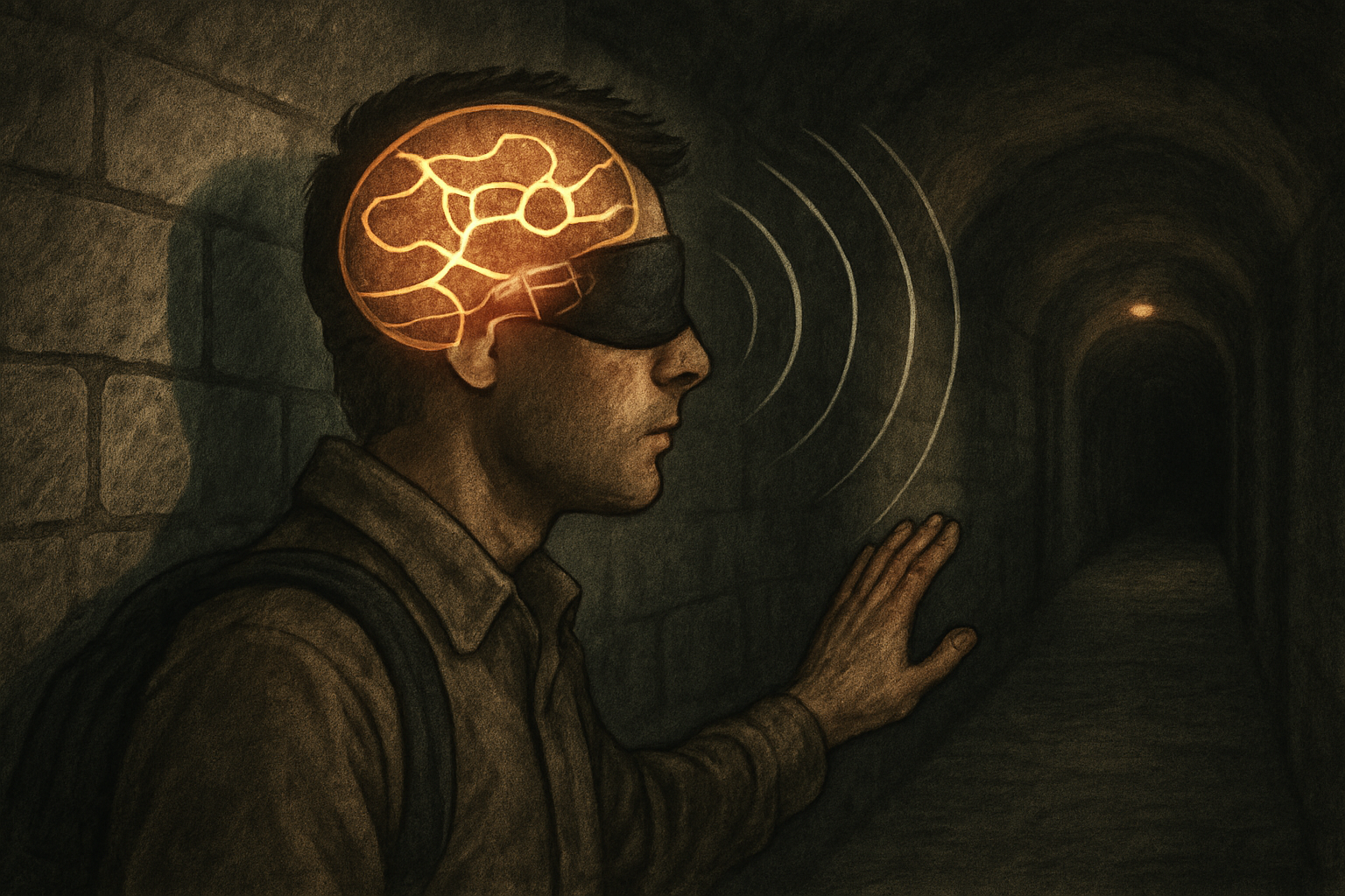
In the absence of GPS, individuals navigating subterranean environments must rely heavily on available sensory information and environmental cues. Visual cues, even when sparse or ambiguous, play a significant role. The geometry of tunnels, distinct geological formations, man-made structures, or even subtle changes in wall textures can serve as landmarks. Dickmann et al. (2024) propose that optimally located cardinal lines and landmarks can support and stabilize neurocognitive structures that promote spatial orientation, suggesting that the design of underground spaces could incorporate such principles.
Beyond visual input, other sensory modalities contribute to spatial awareness. Auditory cues, such as the echo characteristics of a space, can provide information about its size and shape. Tactile information, like the slope of the ground or the texture of surfaces, also aids in orientation and movement. The brain integrates these multimodal sensory inputs to construct and continuously update the cognitive map of the subterranean environment. The challenge lies in environments where such cues are minimal, repetitive, or misleading, which can lead to disorientation and navigational errors.
Psychological and Neurobiological Correlates of Underground Spatial Awareness
Several psychological and neurobiological factors influence an individual's ability to develop and use cognitive maps in underground settings. Psychologically, an individual's 'locus of control'—whether they perceive themselves as having control over their environment—can impact their attitude towards and willingness to engage with underground spaces (Lee et al., 2025). A lower external locus of control may correlate with better adaptation and navigation. Furthermore, the concept of 'presence,' often studied in virtual reality environments, describes the feeling of 'being there' in a space. Higher presence in a simulated or actual underground environment could enhance spatial learning and cognitive map formation.
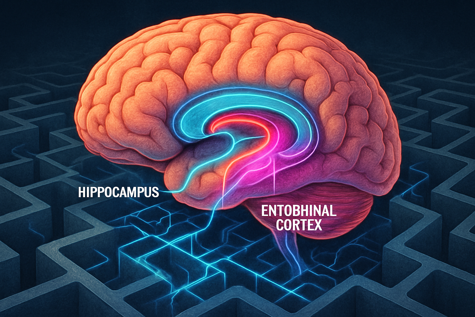
Neurobiologically, specific brain structures and cell types are fundamental to spatial navigation. Place cells in the hippocampus are thought to encode specific locations, while grid cells in the entorhinal cortex provide a metric framework for mapping space (Jeffery, 2023). The activity of these cells helps create a 'mosaic structure' for the cognitive map, which may be fragmented and variably metric depending on environmental complexity and boundaries (Jeffery, 2023). In complex 3D subterranean environments, the traditional understanding of these 2D mapping systems is challenged, and ongoing research, such as the BIG framework integrating geometry cells (Sun et al., 2024), explores how the brain might represent and navigate such volumetric spaces. The perceived ambiguity and potential threat in underground environments can also impact cognitive and physiological responses, influencing memory and spatial processing (McCall et al., 2022).
Cognitive Cartography in Practice: Applications and Future Directions
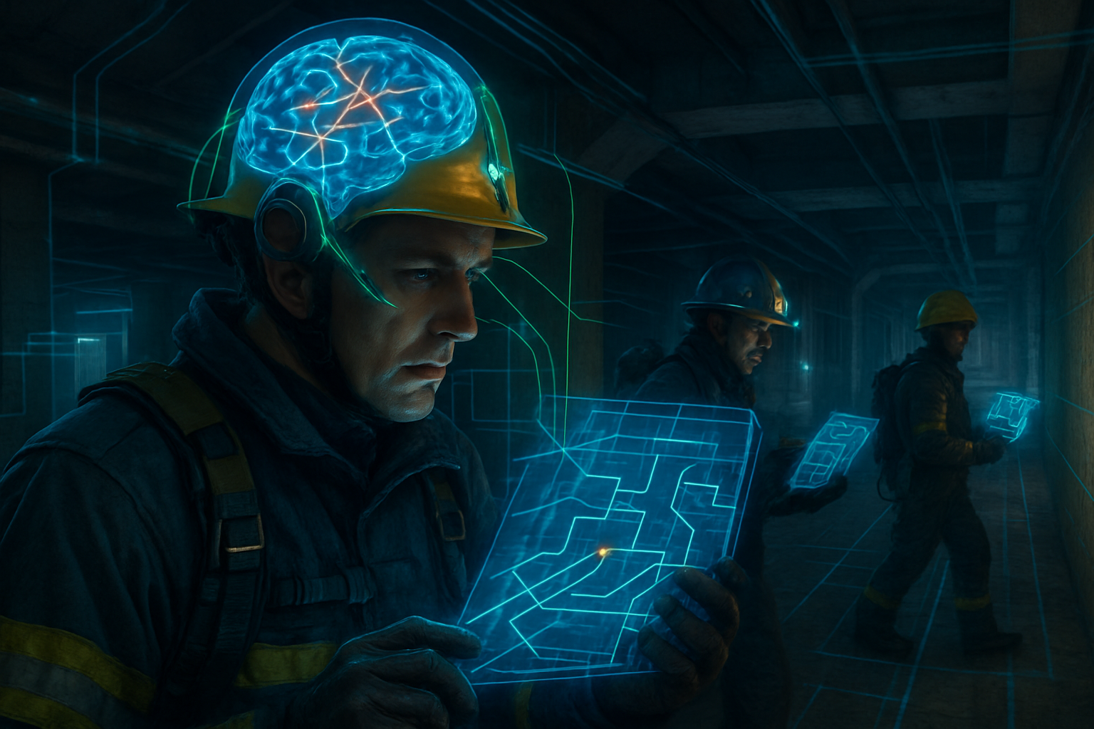
Research into cognitive cartography for subterranean navigation has significant practical implications. Enhanced understanding can inform training programs for emergency responders (e.g., firefighters, mine rescue teams) who must navigate complex underground structures under high-stress conditions. It can also guide the architectural design of underground facilities (e.g., subways, UOWs as described by Lee et al., 2025) to be more intuitive and less disorienting, incorporating features that aid natural wayfinding. Furthermore, this knowledge can contribute to the development of human-centered assistive navigation technologies for GPS-denied environments, potentially leveraging augmented reality or brain-computer interfaces to supplement an individual's natural spatial awareness.
Future research should focus on several key areas. Longitudinal studies are needed to understand how prolonged exposure to subterranean environments affects cognitive mapping abilities and adaptation. Individual differences in spatial skills, anxiety levels, and sensory processing also warrant further investigation to tailor training and technological aids. The development of robust 3D cognitive mapping models that account for verticality and complex, multi-level structures is a critical theoretical challenge. Investigating how teams collectively build and share spatial knowledge in underground operations is another important avenue. Finally, exploring non-visual cues (e.g., olfactory, barometric pressure changes) and their integration into cognitive maps could reveal underappreciated aspects of subterranean wayfinding.
Conclusion
Cognitive cartography for subterranean navigation is a burgeoning field that seeks to understand how humans perceive, represent, and navigate the unique challenges of GPS-denied underground environments. By synthesizing insights from spatial cognition, neuroscience, psychology, and engineering, we can gain a deeper appreciation for the sophisticated internal mapping systems humans employ. This knowledge not only advances our theoretical understanding of spatial awareness but also paves the way for innovative solutions that enhance safety, efficiency, and human well-being in the increasingly utilized subterranean realm. Addressing the complexities of 3D navigation, sensory deprivation, and psychological factors will be key to unlocking the full potential of human adaptability in these enigmatic spaces.
References
- Brunyé, T. T., Gardony, A. L., Holmes, A., & Taylor, H. A. (2018). Spatial decision dynamics during wayfinding: intersections prompt the decision-making process. Cognitive Research: Principles and Implications. https://doi.org/10.1186/s41235-018-0098-3
- Dickmann, F., Keil, J., Korte, A., Edler, D., O ́Meara, D., Bordewieck, M., & Axmacher, N. (2024). Improved Navigation Performance Through Memory Triggering Maps: A Neurocartographic Approach. KN - Journal of Cartography and Geographic Information. https://doi.org/10.1007/s42489-024-00181-x
- Jeffery, K. J. (2023). The mosaic structure of the mammalian cognitive map. Learning & Behavior. https://doi.org/10.3758/s13420-023-00618-9
- Lee, E. H., Roberts, A. C., Kwok, K., Car, J., Soh, C., & Christopoulos, G. (2025). Towards the Vertical City: psychosocial mechanisms for human-centered underground office spaces. Scientific Reports. https://doi.org/10.1038/s41598-025-89590-0
- McCall, C., Schofield, G., Halgarth, D., Blyth, G., Laycock, A., & Palombo, D. J. (2022). The underwood project: A virtual environment for eliciting ambiguous threat. Behavior Research Methods. https://doi.org/10.3758/s13428-022-02002-3
- Sun, Z., Ma, K., Xia, S., Wu, Q., Xiong, C., Xiang, Y., & Pei, L. (2024). BIG: a framework integrating brain-inspired geometry cell for long-range exploration and navigation. Satellite Navigation. https://doi.org/10.1186/s43020-024-00156-3
- Voegeli, B., Sommer, S., Knaden, M., & Wehner, R. (2024). Vector-based navigation in desert ants: the significance of path-integration vectors. Journal of Comparative Physiology A. https://doi.org/10.1007/s00359-024-01725-2